


Lake Shore Voting District, Cass County, Minnesota
About
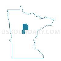
Outline

Summary
| Unique Area Identifier | 601391 |
| Name | Lake Shore Voting District |
| County | Cass County |
| State | Minnesota |
| Area (square miles) | 18.15 |
| Land Area (square miles) | 12.70 |
| Water Area (square miles) | 5.45 |
| % of Land Area | 69.98 |
| % of Water Area | 30.02 |
| Latitude of the Internal Point | 46.49508120 |
| Longtitude of the Internal Point | -94.36130390 |
Maps


Graphs
Select a template below for downloading or customizing gragh for Lake Shore Voting District, Cass County, Minnesota


Neighbors
Neighoring Voting District (by Name) Neighboring Voting District on the Map
- East Gull Lake Voting District, Cass County, MN
- Fairview Twp. Voting District, Cass County, MN
- Homebrook Twp. Voting District, Cass County, MN
- Loon Lake Twp. Voting District, Cass County, MN
- Nisswa City Voting District, Crow Wing County, MN
- Pequot Lakes City Voting District, Crow Wing County, MN
- Red Prec., Crow Wing County, MN
Top 10 Neighboring County Subdivision (by Population) Neighboring County Subdivision on the Map
- First Assessment UT, Crow Wing County, MN (5,424)
- Pequot Lakes city, Crow Wing County, MN (2,162)
- Nisswa city, Crow Wing County, MN (1,971)
- Lake Shore city, Cass County, MN (1,004)
- East Gull Lake city, Cass County, MN (1,004)
- Fairview township, Cass County, MN (821)
- Loon Lake township, Cass County, MN (540)
- Home Brook township, Cass County, MN (255)
Top 10 Neighboring Place (by Population) Neighboring Place on the Map
- Pequot Lakes city, MN (2,162)
- Nisswa city, MN (1,971)
- Lake Shore city, MN (1,004)
- East Gull Lake city, MN (1,004)
Top 10 Neighboring Unified School District (by Population) Neighboring Unified School District on the Map
- Brainerd Public School District, MN (42,588)
- Pequot Lakes Public School District, MN (9,874)
- Pillager Public School District, MN (5,216)
Top 10 Neighboring State Legislative District Lower Chamber (by Population) Neighboring State Legislative District Lower Chamber on the Map
Top 10 Neighboring State Legislative District Upper Chamber (by Population) Neighboring State Legislative District Upper Chamber on the Map
Top 10 Neighboring 111th Congressional District (by Population) Neighboring 111th Congressional District on the Map
Top 10 Neighboring Census Tract (by Population) Neighboring Census Tract on the Map
- Census Tract 9509, Crow Wing County, MN (5,331)
- Census Tract 9504, Crow Wing County, MN (5,233)
- Census Tract 9607, Cass County, MN (4,426)
- Census Tract 9608.02, Cass County, MN (4,364)
- Census Tract 9608.01, Cass County, MN (3,526)
- Census Tract 9505.01, Crow Wing County, MN (2,675)